
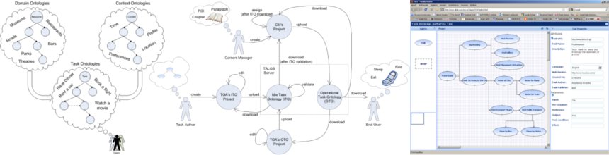
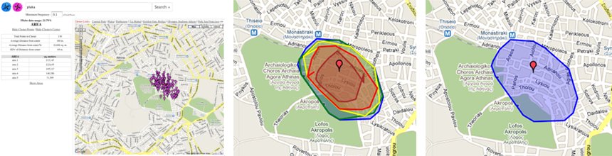

| Geospatial Content |
|
Geospatial data has become an important resource in today's Web applications not only as content but also as metadata. Despite its undisputed usefulness, issues need to be addressed with respect to the availability, the accuracy and the cost of the data. Geospatial data has typically been generated and, thus, curated by professionals, e.g., surveying firms and large map data providers. The advent of Web2.0 created several creative-commons initiatives addressing geospatial dataset creation. The following screencast shows how to exploit such user-contributed data by deriving integrated geospatial datasets from user-contributed data.
|